
Huntsville State Park
- Bryce & Kaylee

- Jun 8, 2020
- 4 min read
Updated: Oct 24, 2020
Things may not always go as planned; you just gotta roll with it.

Howdy! Kaylee here to tell you about our visit to Huntsville State Park; Bryce said I could write this whole blog because there was a little piece I wanted to share anyways. About a month before, when some of the state parks had started shutting down while others stayed open, Bryce and I were trying to figure out which parks were close enough to visit and saw that Huntsville was only about an hour away. But, to our dismay, the park has decided to close operations due to COVID-19. Fortunately for us, the park had reopened with the precautionary social distancing guidelines like all of the other parks.
We were looking at the Huntsville trail map the night before, like we always do, to figure out the best trails to hit up the most ‘points of interest’. We noticed that three of the six attractions were located right off of the same trail, which turned out to be 6.8 miles long. Normally the trails we decided to take are around 2 miles round trip or less, but we saw this one as good practice for visiting larger state and national parks when we might spend the whole day walking. We woke up the next morning, got ready, and packed our backpacks up with the things we needed for the day. Those things included my camera and an extra lense (of course), our signature sack lunches complete with gushers and cheese sticks, and a hammock and books for a little relaxing after the hike. With our backpacks, water bottles, and Costa sunglasses, we were on our way!
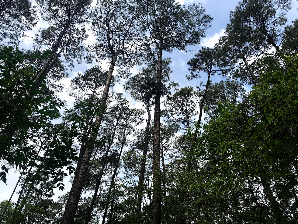
I drove on the way to Huntsville and got us checked in at the headquarters (the volunteers there are always so nice). Then, we found a parking spot near the trail and started off on our 6.8 mile journey. A little ways into the walk, I decided to pull out my camera so I could start taking pictures. However, it quickly became evident to me that the camera had been on all night and the battery was completely drained. I started to get really sad and pouty, but Bryce kept telling me not to let that ruin our trip. He said, “Remember, it’s just nice being out in nature with each other.” That put on a smile on my face, and I decided to turn this into an opportunity. We all carry a camera around with us all the time: our smartphones! I had charged my phone up the night before, so I knew I could count on that battery life. I seized the moment and decided to work on my iPhone landscape photography (and I actually really enjoyed how some of them turned out).

With that mess behind us, we continued down the trail. It didn’t take long for us to encounter our first bridge. We noticed it was labeled with a number this time and assumed that how the volunteers know which bridge to go repair. This also meant that we would get to encounter more bridges along the way! After a little over a mile, we came out to this dock that extended in part of the swamp-like terrain that had formed in the area. It was really neat to see all of the different wildlife that had formed so close together in that region.
It was a little before noon, and Bryce and I were both starting to get a little hungry at that point. However, we decided to keep walking until we came up on another bench. We didn’t think it would be another two miles before we reached that bench but oh well. The bench was actually in a really pretty spot that sat off the trail out amongst the trees. We finished lunch and still had a couple snacks to keep for later on in the hike.
Around four miles into the trail, we came around closer to the lake and to our next attraction point: a dam and spillway built by the CCC. We found a little pathway that other people had made that led down to the rocky area beneath the spillway. I was taking photos of the area and bryce suggested that I try and walk across some of the rocks so he could take some of me. Let’s just say I’m not the most graceful rock walker, and Bryce made sure to point that out to me. I made him do the same, so I could get some good shots of him, then called him back over so we could take some cute self-timer pictures together. Next, I snapped some ring pictures then we were climbing through the brush to get back to the trail and on our way.


We only had a few more miles left to go on this outing, spending the rest of this time talking and taking in the nature around us. In total, we came across 16 different marked bridges (is this the best trail ever or what!?) and a sign that said, “Area Closed, Do Not Enter,” so obviously we had to. It had been a while since we had seen a mile marker and were getting a little worried. Luckily, we came up to the Mile 6 marker and realized we had less than a mile to go. Before we had to leave the cover of the trees, I made Bryce stop and take more cute pictures with me. Then we finished up the trail. This was by far the most walking we had done at a state park since Bryce was able to triple his move and exercise goals.
We got back to the car and drove a little way down to check out a lodge built by the CCC right off of the lake. We set up the hammock and spent some time reading before driving back to College Station. Bryce had this shift to drive, and myself being exhausted, fell asleep in the passenger seat. Bryce was able to perfectly capture what I look like when I sleep in the car: my mouth wide open. All in all, this wound up being a very fun day, despite the saddening beginning. Sometimes you plan for things to go one way and they wind up not working. Oh well, I guess that’s life. You just have to learn to make do with what you have and bring the fun to every situation.


Comments